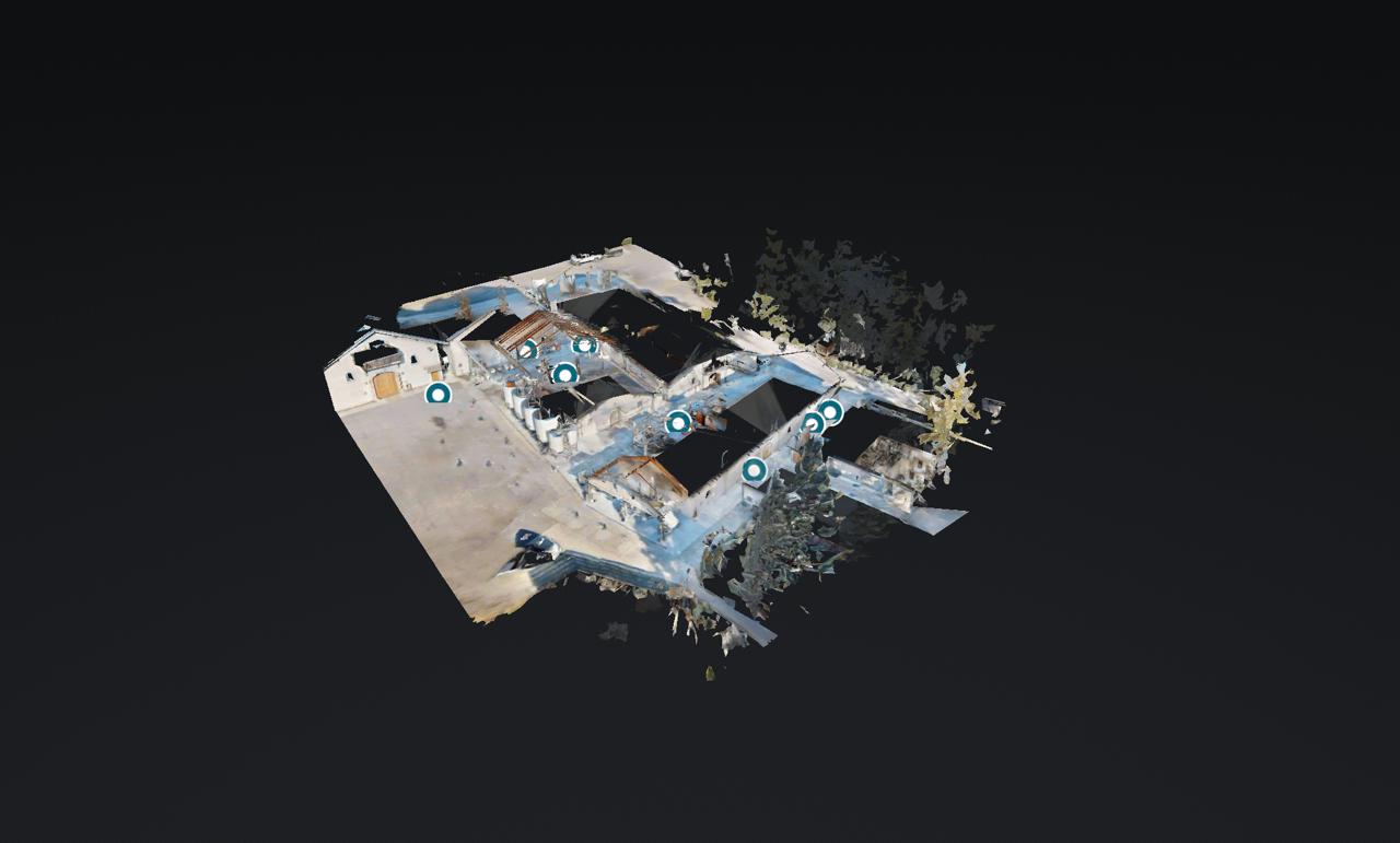
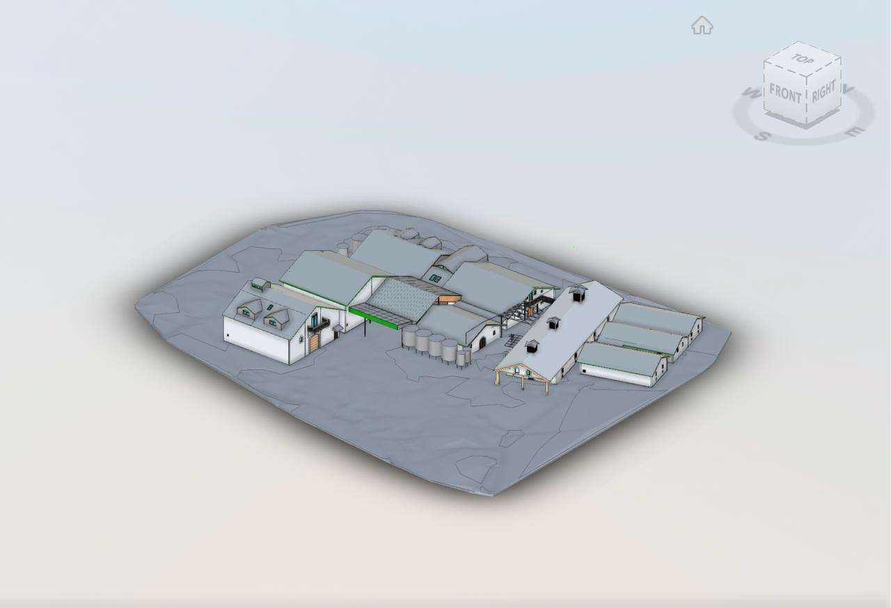
Duckhorn Vineyards
Before
After
View Live 3D Model
Includes: Construction Plans, Finish Plans, Power Plans, Interior Elevations, Enlarged Plans
(650) 437-7630
Commercial and AEC Services
We capture your space with Matterport Pro3 LiDAR and deliver production-ready Revit models, DWG floor plans, and construction documents for architecture, engineering, and construction teams. Our pricing runs well below industry average, making professional scan-to-BIM accessible without compromising on quality or turnaround.
LOD 300
Model Fidelity
1-2 wk
Typical Turnaround
3M+ sq ft
Captured and Modeled
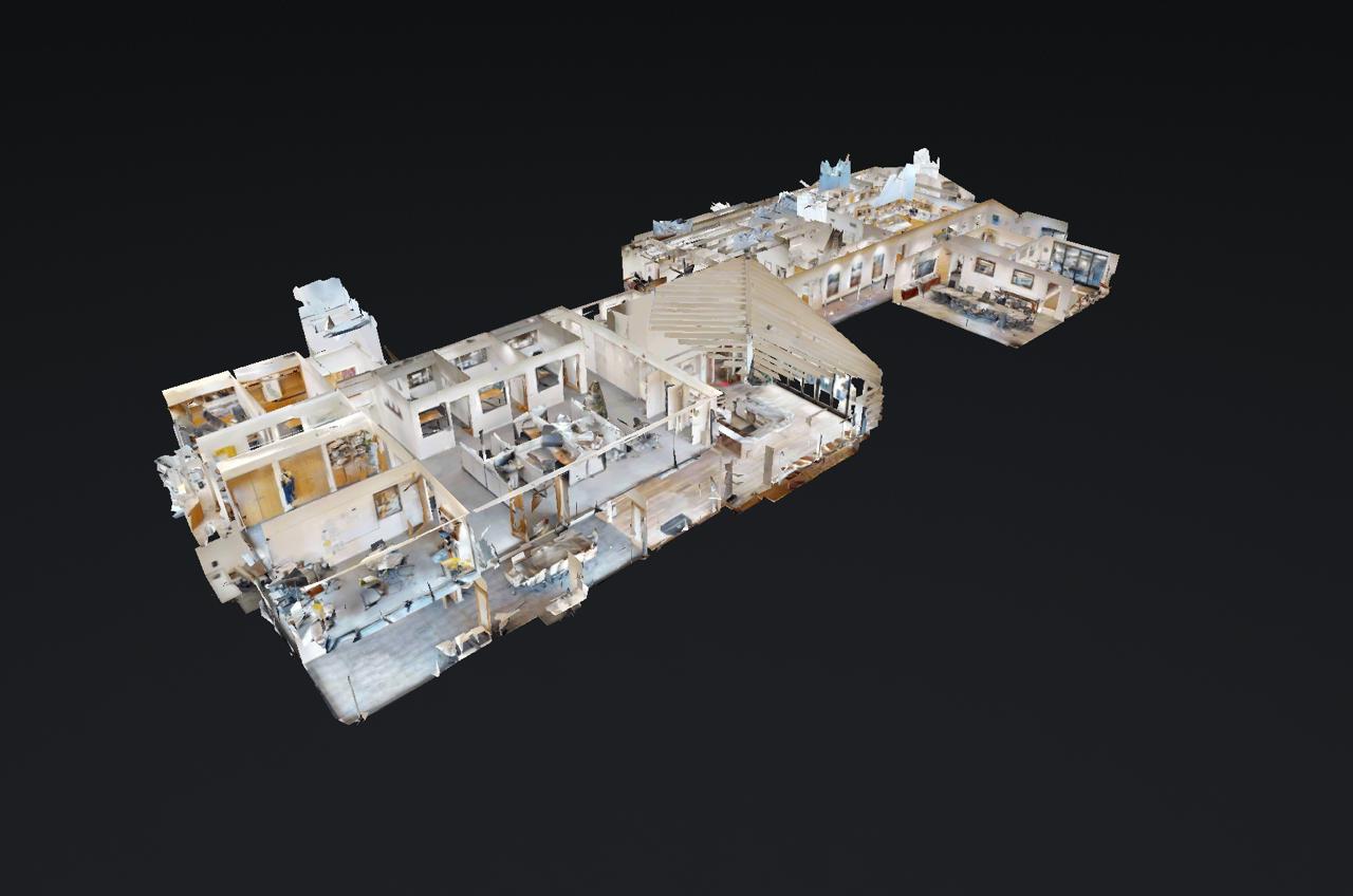
Before
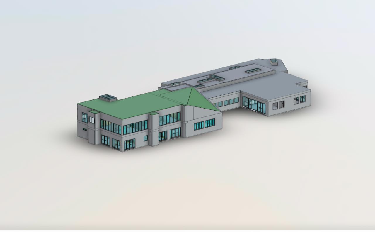
After
Includes: Construction Plans, Finish Plans, Power Plans, Interior Elevations, Enlarged Plans
Before
After
Includes: Construction Plans, Reflected Ceiling, Finish Plans, Furniture Plan, Power Plans, Interior Elevations
Before
After
Includes: Construction Plans, Electrical Plans, Finish Plans, Power Plans, Interior Elevations, Wall Sections
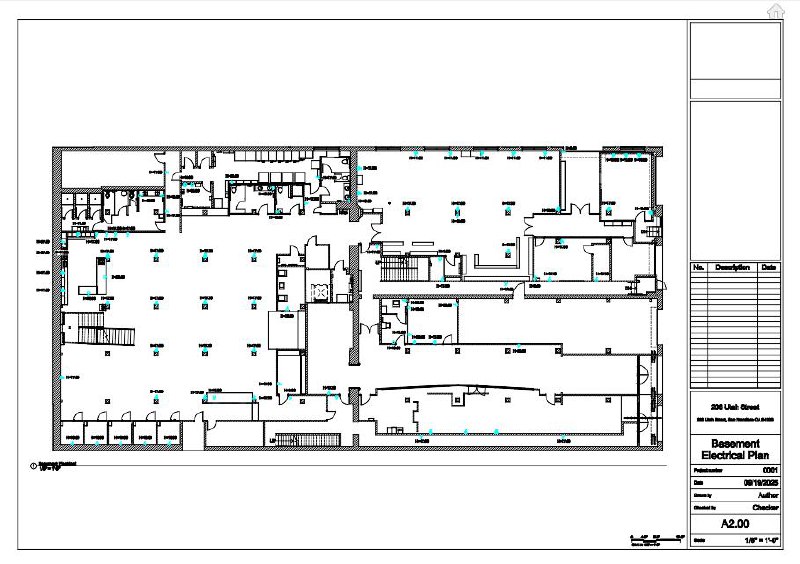
3D models tell the story. But floor plans, electrical plans, and construction documents are what your design team works from every day. We deliver both.
One of multiple sheets delivered for a 4-story, 78,000 SF commercial building. Includes receptacle locations, panel schedules, circuit allocations, and more.
Send us your plans, or start from our Matterport scan. We deliver construction plans, finish plans, power plans, interior elevations, wall sections, and MEP drawings directly from the model into AutoCAD or Revit.
We provide aerial mapping for site planning, earthwork measurements, and construction progress tracking. Pair it with our scan-to-BIM services for complete existing conditions documentation, from the roof down to the floor plan.
High-resolution aerial composites stitched from hundreds of overlapping drone images via automated grid flight paths for accurate site documentation
Digital surface and terrain models for grading analysis, site planning, and elevation studies
Precise cut-and-fill calculations for earthwork, stockpile tracking, and excavation verification
Scheduled aerial captures to track construction milestones and compare against project timelines
Drone-derived contour maps and elevation data for civil engineering and landscape architecture
Close-range aerial imaging for condition assessments without scaffolding or lift equipment
Drone-captured photogrammetry of a historic church in San Mateo, CA. Processed from hundreds of aerial photographs into an interactive 3D point cloud. Rotate, zoom, and explore.
Our BIM deliverables are built for active design work. We prioritize geometry integrity, layer consistency, and clean model structure so architects can move from existing conditions into documentation quickly.
Reliable wall centerlines and openings for design layout
Organized model structure for fast consultant coordination
Documentation-ready output your architects can use immediately
Tell us your site size, deliverables, and timeline. We will scope the project and return with a clear proposal.